Archaeological sites contain information that cannot always be seen from the surface. Buried walls, foundations, pathways, graves, floors, storage areas, and other features can remain hidden beneath soil for centuries. Finding these features traditionally requires excavation, but removing soil can be expensive, time-consuming, and potentially damaging to the very evidence researchers are trying to preserve.
Archaeology GPR offers a different approach. Ground penetrating radar allows researchers to investigate what may be beneath the surface without immediately disturbing the site. By sending electromagnetic signals into the ground and recording their reflections, GPR can reveal patterns associated with buried structures and changes in subsurface materials.
How GPR Supports Archaeological Research
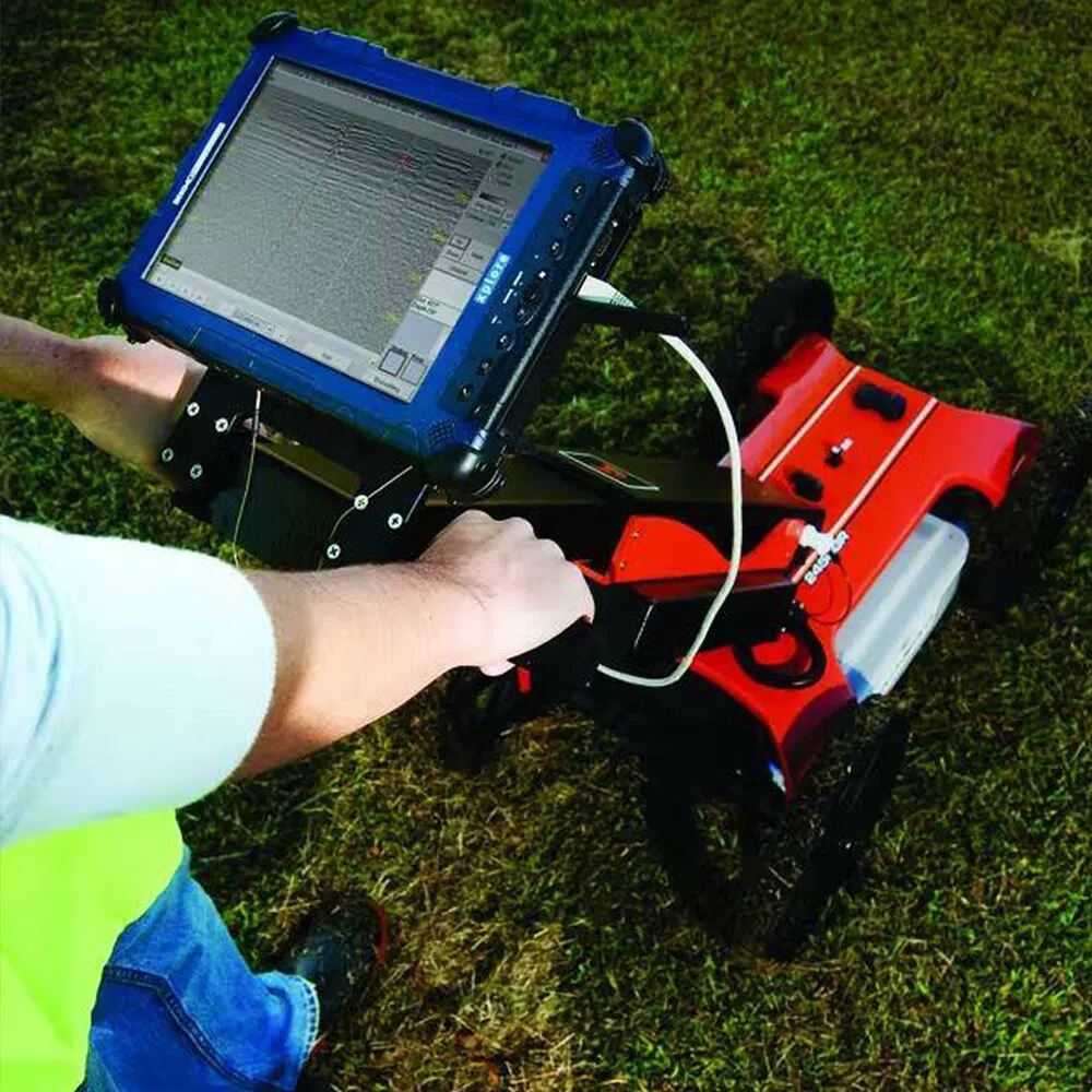
Ground penetrating radar is a non-destructive geophysical technique. Instead of removing soil to locate an archaeological feature, researchers can survey the surface and analyze the radar responses produced below it.
The radar system sends short electromagnetic pulses into the ground. When these signals encounter a boundary between materials with different physical properties, some energy is reflected back toward the antenna.
As the antenna moves across the site, thousands of measurements can be collected. These measurements create radar profiles that can later be processed and analyzed to identify patterns that may correspond to buried archaeological features.
The technique does not provide a simple photograph of an ancient structure. Rather, it produces subsurface information that researchers interpret alongside archaeological knowledge, historical records, maps, topography, and other evidence.
What Can Archaeology GPR Detect?
GPR can be useful for identifying many types of buried features. Depending on the site conditions, researchers may detect walls, foundations, floors, roads, graves, pits, ditches, buried objects, and changes in soil composition.
A buried wall, for example, may create a different radar response from the surrounding soil. A trench or filled pit can also produce a detectable contrast.
One of the most valuable aspects of GPR is that it can reveal patterns across an entire survey area. Rather than investigating one small location at a time, researchers can collect data across a larger section and examine how individual features relate to each other.
This can help create a broader understanding of how a site may have been organized.
Archaeological Survey Without Immediate Excavation
Excavation remains an important part of archaeology, but it permanently changes the area being investigated. Once soil has been removed, the original arrangement of deposits cannot simply be restored.
GPR provides an opportunity to investigate a site before making that decision.
Researchers can survey an area and identify zones containing potentially significant anomalies. These areas may then be prioritized for additional research or carefully targeted excavation.
This approach can reduce unnecessary disturbance while helping archaeologists focus their resources on locations that appear particularly significant.
Mapping Buried Structures
One of the strongest applications of GPR in archaeology is subsurface mapping.
A survey can be organized into a grid, with radar data collected along multiple parallel lines. When enough data is collected, software can process the measurements at different depths.
Depth-based visualization can reveal features that become visible at particular levels below the surface. Researchers can compare these patterns to determine whether individual reflections represent isolated objects or parts of larger structures.
This can be particularly useful at sites where several generations of construction may have occurred. Different walls, floors, or other features may appear at different depths, providing clues about how the site changed over time.
GPR and Archaeological Excavation
GPR does not necessarily replace excavation. Instead, it can help make excavation more targeted.
Suppose a large archaeological site contains several hectares of potentially important ground. Excavating the entire area may not be practical. A GPR survey can help researchers identify locations where subsurface patterns suggest buried structures or other features.
Archaeologists can then compare the geophysical results with surface observations and historical information before deciding where excavation may provide the greatest research value.
When excavation eventually takes place, the radar data can also provide a useful framework for interpreting what is uncovered.
Investigating Historic Buildings and Ruins
Archaeology GPR is not limited to open fields. The technology can also be used around historic buildings, ruins, courtyards, roads, and other developed environments.
Researchers may investigate the remains of foundations beneath modern surfaces or examine areas surrounding existing structures.
In some situations, GPR can help determine whether apparent surface features continue below ground. It may also reveal buried extensions, earlier construction phases, or features that are no longer visible.
This makes GPR valuable for understanding how historic locations evolved rather than examining individual artifacts in isolation.
Archaeological Sites and Graves
GPR is also associated with the investigation of potential burial features. Changes in soil structure caused by digging and refilling a grave can sometimes produce detectable radar responses.
Researchers can use this information to identify areas that may warrant further investigation while minimizing unnecessary disturbance.
The interpretation of burial-related radar data requires particular care. A radar anomaly does not automatically confirm the presence of a grave or human remains. Soil conditions, roots, rocks, modern disturbances, and other factors can produce similar responses.
For this reason, archaeological interpretation should consider multiple forms of evidence.
The Importance of GPR Data Processing
Collecting radar information is only one part of an archaeological survey. The raw data must be processed to make meaningful patterns easier to identify.
Specialized software can help correct positioning variations, remove certain forms of background noise, adjust signal characteristics, and create different visual representations of the collected information.
Researchers may examine individual radar profiles as well as horizontal depth slices. These views can reveal different aspects of the same buried feature.
Three-dimensional visualization can provide an even broader perspective by showing how anomalies appear across several depths.
Factors That Influence Archaeology GPR Results
Not every archaeological site is equally suitable for GPR. Ground conditions have a major effect on how deeply radar signals can travel and how clearly features can be detected.
Clay-rich or highly conductive soils can significantly reduce penetration. Moisture can also influence radar behavior. Vegetation, surface materials, modern infrastructure, rocks, roots, and previous excavation can create additional complexity.
The choice of antenna frequency also matters. Higher frequencies can provide greater detail for shallow features, while lower frequencies can be useful when deeper penetration is required.
Survey design must therefore be matched to the site's expected conditions and archaeological objectives.
Combining GPR With Other Archaeological Methods
The most useful archaeological investigations often combine several types of evidence.
GPR can be used alongside historical maps, aerial imagery, surface surveys, topographic information, magnetometry, electrical resistivity, and carefully selected excavation.
Each technique provides a different perspective. GPR may reveal buried structures, while another geophysical method may respond more strongly to a different type of feature.
Combining these datasets can help researchers distinguish meaningful archaeological patterns from natural or modern disturbances.
Preserving Information for Future Research
Another advantage of digital GPR surveys is that the collected information can be preserved and revisited.
Unlike an excavation that physically removes archaeological layers, geophysical data can be stored digitally. Researchers can return to the dataset later, apply improved processing methods, or compare it with information collected during future investigations.
This creates a valuable record of the site's subsurface characteristics and can support archaeological research beyond the original field survey.
The Growing Role of GPR in Archaeology
Archaeology GPR has become an important tool for researchers seeking to understand buried environments while limiting unnecessary disturbance. It can reveal patterns that are invisible at the surface and provide valuable information before excavation begins.
Its greatest value comes from combining technology with archaeological interpretation. Radar data alone cannot explain an entire site, but when it is evaluated alongside historical evidence, field observations, other geophysical methods, and excavation results, it can provide a much richer picture of what lies underground.
For archaeological projects where preservation, efficient investigation, and spatial understanding are priorities, GPR offers a powerful way to explore the past while leaving much of the ground untouched.