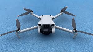
In today’s fast-moving industrial landscape, precise mapping and 3D modeling are essential for construction, surveying, agriculture, oil & gas, and infrastructure development. In the UAE, where mega-projects are a constant, businesses rely on accurate aerial data to ensure efficiency, safety, and cost-effectiveness. DJI Enterprise drones have become industry leaders, offering cutting-edge technology that dramatically improves mapping and 3D modeling accuracy.
Precision with RTK and GNSS Systems
DJI Enterprise drones feature Real-Time Kinematic (RTK) positioning technology, providing centimeter-level accuracy for mapping and modeling. Combined with advanced GNSS systems, RTK ensures consistent results even in challenging environments, from high-rise urban areas to remote desert landscapes.
High-Resolution Imaging
The quality of aerial imagery directly impacts mapping accuracy. Drones like the DJI Matrice 350 RTK and Phantom 4 RTK capture high-resolution images, producing detailed orthomosaics, digital elevation models (DEMs), and 3D reconstructions. High-quality visuals also make it easier to spot small structural issues or landscape features.
Advanced Payload Options
DJI Enterprise drones support a variety of payloads, including LiDAR sensors, thermal cameras, and multispectral sensors. The Zenmuse L1 LiDAR, for example, captures dense point clouds for precise elevation data—even in dense vegetation or low-light conditions. These tools allow industries to create highly detailed and realistic models of construction sites, pipelines, and powerlines.
Smart Flight Planning and Automation
Intelligent flight planning software lets DJI drones follow pre-set flight paths with precise overlap ratios, ensuring consistent image capture. Automation reduces human error, saves time, and enables fast mapping of large-scale projects.
Real-Time Data Processing
Many DJI Enterprise drones integrate with cloud platforms and onboard AI, providing near-instant results. This allows teams to make faster decisions on inspections, surveys, or project updates, reducing delays and improving workflow efficiency.
Built for Harsh Environments
The UAE’s extreme conditions—high heat, strong winds, and dust—require durable drones. DJI Enterprise models are designed to perform reliably outdoors, ensuring accurate data collection and safe operation across diverse terrains.
Conclusion
DJI Enterprise drones are revolutionizing mapping and 3D modeling with unmatched precision, efficiency, and adaptability. From RTK accuracy and high-resolution imaging to advanced payloads and AI-powered automation, they provide the reliable data UAE industries need to execute projects confidently. As the country continues to expand infrastructure and develop smart cities, DJI drones remain at the forefront of aerial innovation, delivering accurate and efficient solutions at every stage.